Traffic you can see
Live ADS-B on a map and a table, sorted by how close it is, with an alarm for anything low and close to you.
ADG FlySafe · by Argus Defense Group
Wind and gusts with a go/no-go call for the aircraft you pick — small, standard, heavy, ag spray or your own custom limits — plus airspace and LAANC ceilings, TFRs, weather alerts and live air traffic for where you fly: on your phone in the field, on a display in the shop, and on a planning map before you leave. For every drone pilot — commercial, recreational, public safety and ag — and for crewed pilots sharing the same sky.
7 days free, then $18/month or $150/year. Cancel any time.

See it in action
Each one answers a different question: can I fly here, now? What is the day going to do? And what is in the way of the job I am planning?
The go/no-go check for wherever you are standing, built for a bright screen and one hand. It folds every gate — wind, Delta-T, alerts, nearby traffic, airspace — into one verdict at the top, and it still opens where there is no signal.
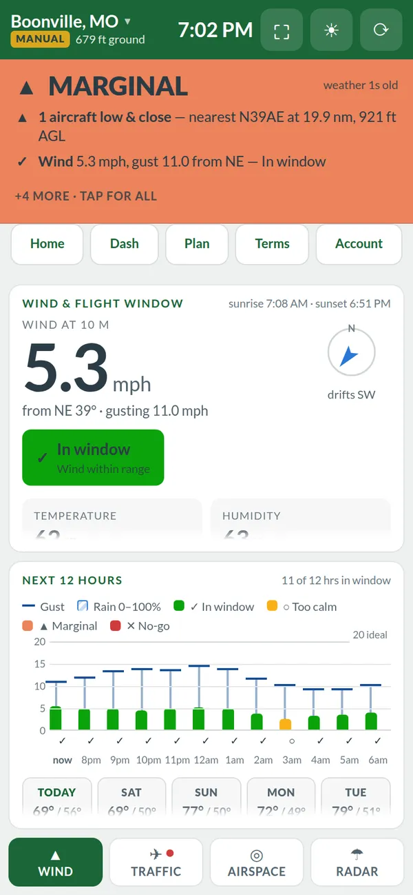
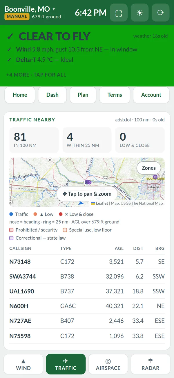
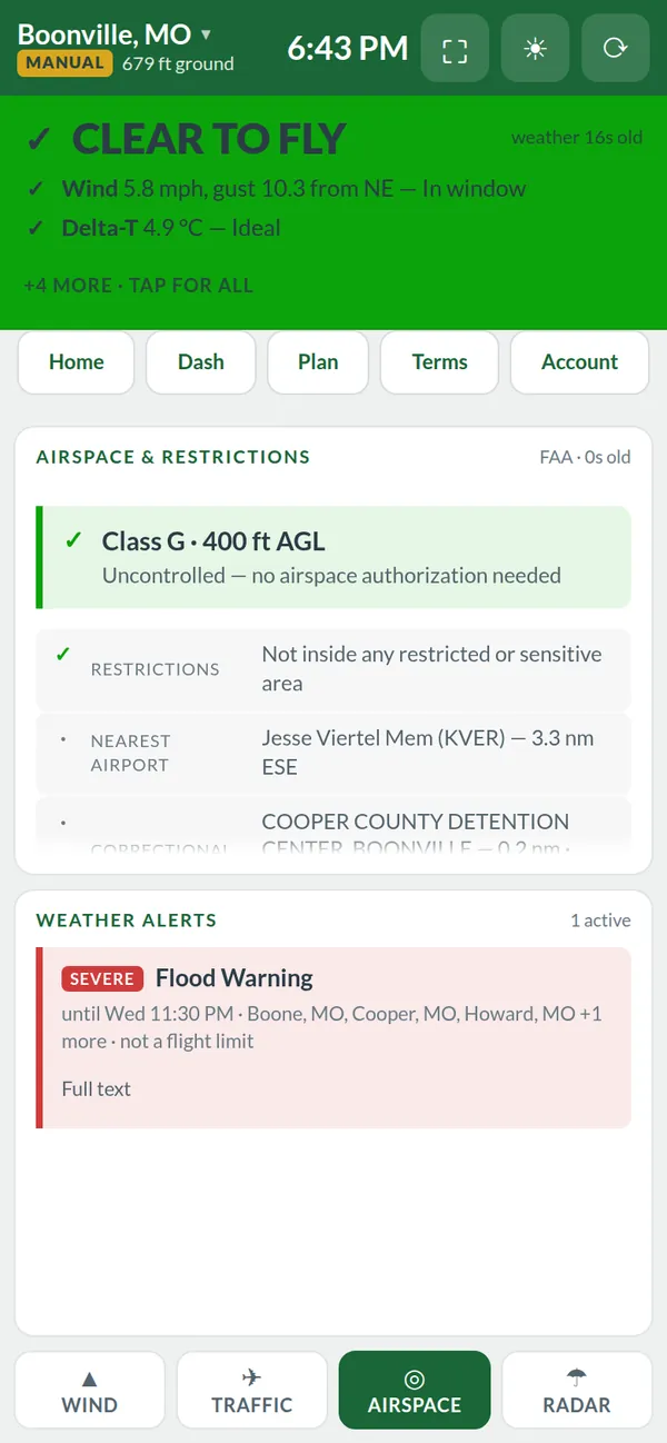
Swipe sideways for more screens.
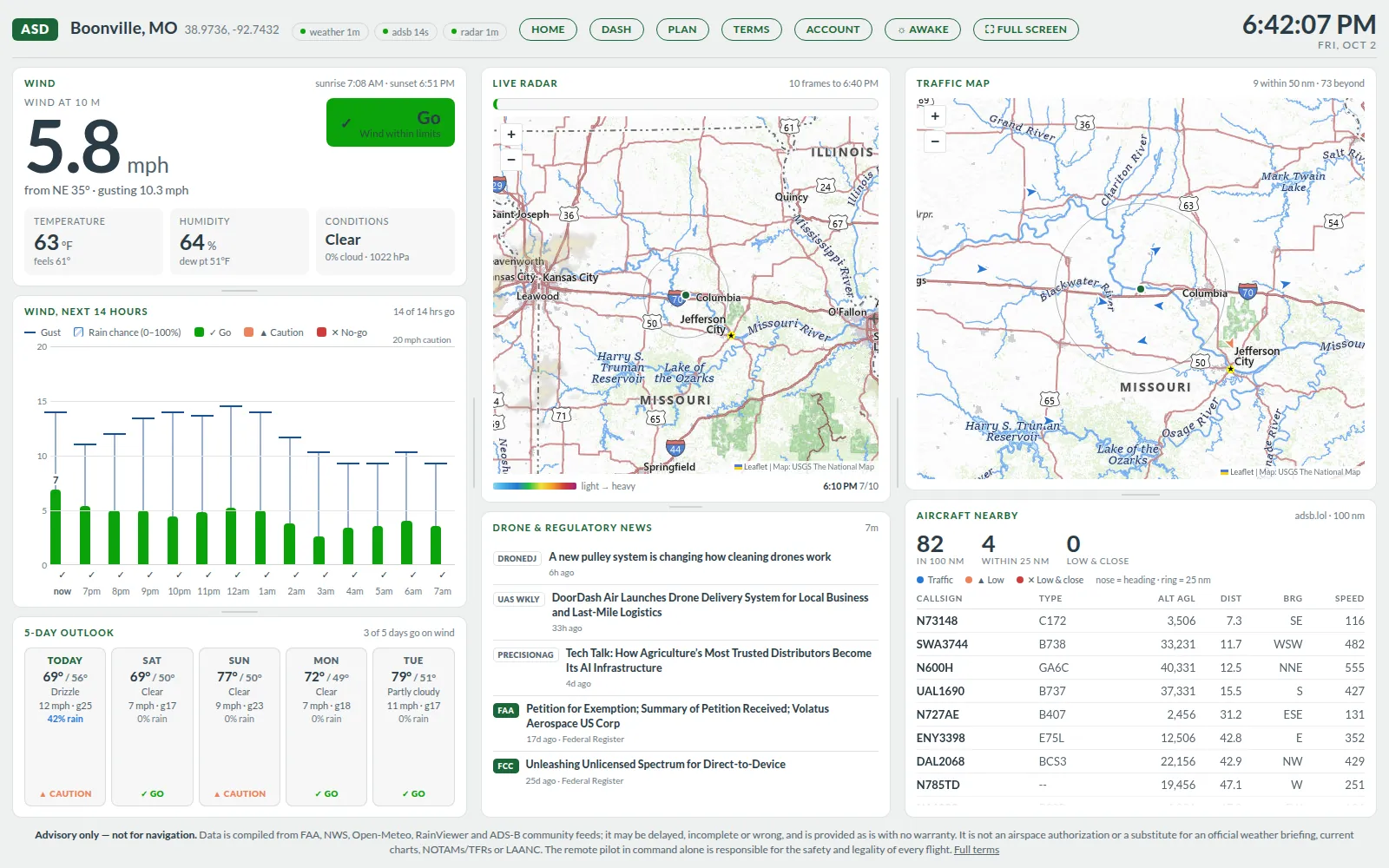
A wall display for the shop or the trailer: the whole day’s picture on one screen, refreshing itself, so the crew can see whether the next load goes out without anyone opening a laptop.
A planning map for the job before you drive to it: FAA facility-map (LAANC) ceilings, towers and obstacles from the FAA Digital Obstacle File, prohibited and special use airspace, and terrain relative to your launch point — then a route.
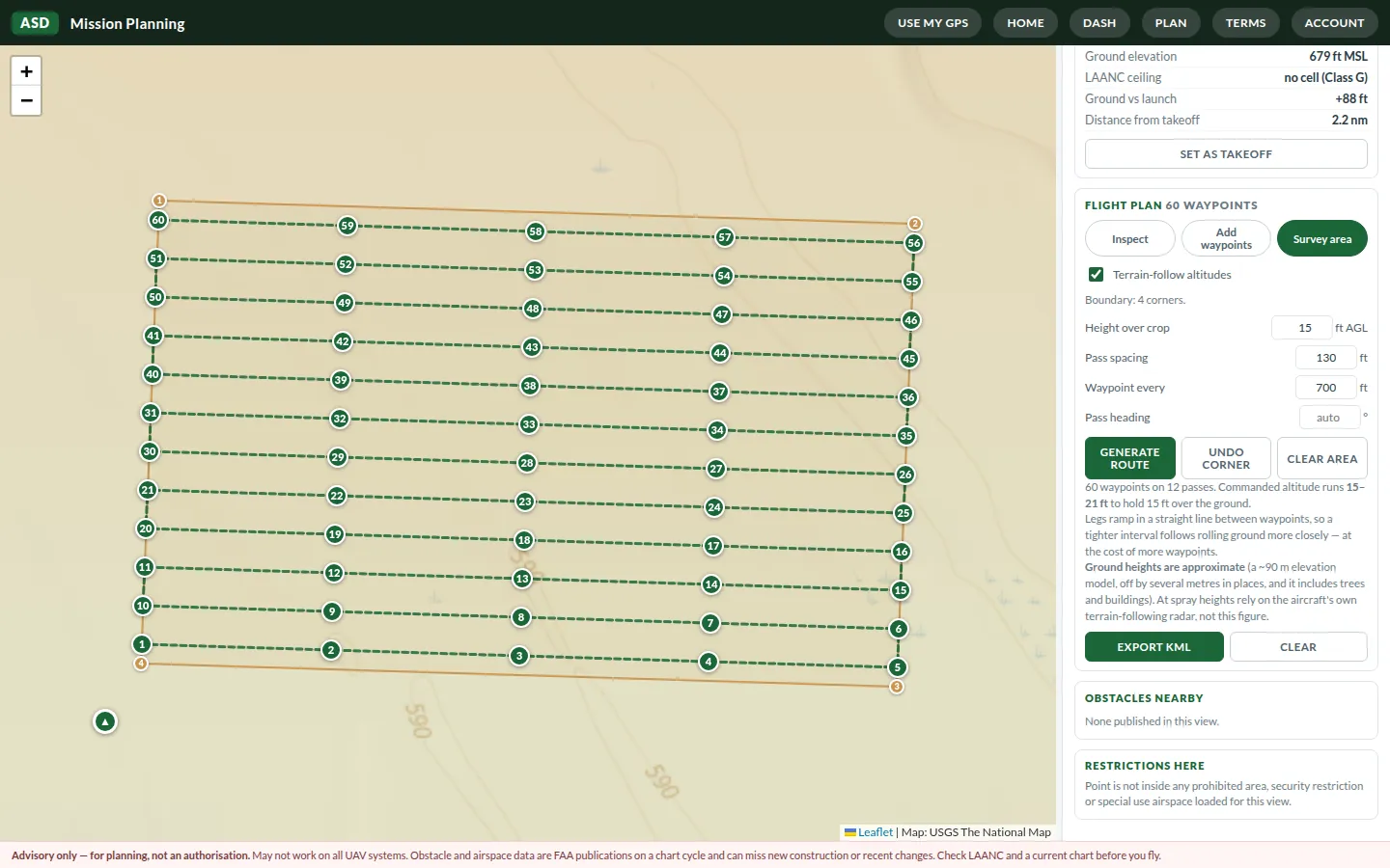
Screenshots are live captures from Boonville, Missouri, taken on 2 October 2026 with real public data. Your screens show your own location and conditions.
What you get
Gathered from official sources — the FAA, the National Weather Service and NOAA radar, and USGS — plus the community ADS-B network adsb.lol, and arranged around the questions you actually ask before a flight.
Live ADS-B on a map and a table, sorted by how close it is, with an alarm for anything low and close to you.
FAA UAS facility-map ceilings, controlled airspace, prohibited and special use areas, stadiums, the nearest airport, and live TFRs.
Wind and gusts with a go/no-go call, a rain countdown, NWS alerts and animated radar. Pick your aircraft profile — small, standard, heavy, ag spray or your own custom limits — and every wind call uses it.
Wind is judged against the profile you pick, from a sub-250 g mini to a Matrice, or limits you set yourself. The ag spray profile adds Delta-T, a too-calm warning and the spray window.
The field app is made for a bright screen and one hand, uses your phone’s location, and still opens where there is no signal.
Towers and obstacles, terrain relative to launch, waypoint and survey routes with terrain-corrected altitudes, and KML export.
Who it’s for
Any drone, any mission — and the crewed pilots sharing the same low-level sky. Works anywhere in the United States the public FAA and NWS data covers.
Survey, mapping, inspection, real estate, film and photo work: airspace and facility-map ceiling, TFRs and towers before you set up.
Know whether the park, the farm or the lake is clear to fly today, and what else is in the air before you put yours up.
Police, fire, SAR and utility teams: a fast go/no-go at the scene, live traffic for helicopters nearby, and a shared screen back at base.
Know whether the next load can go: wind, gusts, Delta-T and the spray window, with low traffic called out before an ag plane or helicopter is on top of you.
Ag aviation and general aviation: nearby ADS-B traffic, wind, alerts and radar for the strip you are flying from.
Put the dashboard on a screen in the shop and carry the field app in your pocket — one subscription covers two devices at once.
How it works
No app store, nothing to install — it runs in the browser on your phone, tablet, laptop or a TV in the shop.
Questions
Yes. New accounts get 7 days free with full access to all three apps. The trial is once per account.
Yes — a card is collected when you start, so nothing stops on day 8. Stripe charges nothing until the trial ends, and if you cancel inside the 7 days you are not charged at all. We never see or store your card number.
Any time, from your account page. Cancelling stops the next renewal and you keep access to the end of the period you have already paid for. Charges already made are generally not refunded — see the terms.
Two signed in at once — say, a display in the shop and a phone in the field. Signing in on a third signs out whichever has been signed in longest, and we email you when that happens.
No. ADG FlySafe is advisory only. A green “go” is a summary of public data against thresholds, not permission; a facility-map ceiling is not a LAANC approval; and an empty traffic scope does not mean empty sky. The pilot in command is responsible for the flight — check the official sources before every flight.
Routes export as KML, which many ground-station apps import. It is for planning, and it may not work on every UAV system, flight controller or app — check every waypoint and altitude in your aircraft’s own software before flight.
Public sources: the FAA (airspace, LAANC, obstacles, TFRs), the National Weather Service (forecasts, station observations, alerts), NOAA radar, USGS (maps and terrain), FEMA (correctional facilities) and the community-fed ADS-B network adsb.lol. The full list, with each source's terms, is in the terms.
Pricing
One subscription for the field app, the operations dashboard and mission planning. 7 days free, then billed — cancel any time.
Already have an account? Sign in